Ontario, Oregon
I am so tired. I'm currently on the eastern edge of Oregon, after a 10-hour drive across the state. Yes, it takes that long to get from the coast to the Idaho border. The route goes over the coastal mountains, through the Willamette Valley, over the Cascade Mountains, across the high desert, through the Oregon Badlands, then over another mountain range. So many ecosystems!
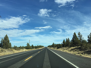 |
| A flat, straight road in Oregon's high desert |
I'm currently moving from Oregon to Massachusetts, and to get there, I'm driving. Well, not just me - my ever-so-supportive mother flew out to Oregon and is making the trip with me. I'm grateful for the added safety her presence provides, and besides, my mom is just fun to travel with.
For our first day on the road, we set off from Coos Bay and headed inland. I had never been east of Willamette Pass, the highest point in highway 58 in the Cascade Range, so the eastern half of the state was a total mystery to me.
 |
| The desolate high desert |
We passed through Bend, which is a city divided. On one side of the highway, there were old, run-down neighborhoods, but on the other side were expensive condos and well-manicured lawns. It reminded me of cities in the deep South, where you can travel to a different universe just by crossing the railroad tracks. Very strange.
 |
| A rocky butte in Oregon's Badlands |
Next, we passed through the Oregon high desert, which is so named because it's at 4,000-4,500 feet of elevation and in a rain shadow cast by the Cascades. I could feel the dry air chapping my lips as we drove. The dirt was red in some areas, and the only plants were low, bushy shrubs. I had been told there was nothing in eastern Oregon, but I always assumed it was relatively nothing (translation: small towns every 20 miles), but no. There was
nothing. We went a hundred miles at a time without seeing so much as a shack. The best way to make you understand the absolute desolation in eastern Oregon is to make you listen to the second movement of
Tabula Rasa by Arvo Pärt. Listen to it
here, and close your eyes.
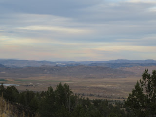 |
| The Blue Mountains in the distance |
I remember seeing exactly two farms in eastern Oregon, because most of the terrain is too dry to grow much of anything. There was a hay farmer with an impressive irrigation system. His fields surrounded the "town" of Hampton, Oregon, and from the looks of it, the population of Hampton is equivalent to the number of people the farmer employs.
The second farm was actually a ranch with a large, fenced-in area and animals that reminded me of spring buck or antelope. After a little Google-ing around, I discovered they were pronghorns, an animal that's native to dry, high-altitude inland areas of North America. Pronghorns are actually in the giraffe family, but they're the ecological equivalent of antelopes, as fast-moving herbivores that are preyed upon by big cats (in this case mountain lions). They're the second-fastest land animal, second only to the cheetah. I never knew such a magnificent animal was native to North America!
As we continued east, the terrain got more and more rugged. We drove through the Oregon Badlands, full of rocky buttes and steep ridges. The landscapes were absolutely beautiful, and we took plenty of pictures. The last part of the drive was through the Blue Mountains, which are absolutely gorgeous.
It was a long, taxing day in the car, but I learned a lot about Oregon. Here's to adventure!


Comments
Post a Comment